About this update
The Jordan Trail is a 650-kilometer long-distance walking route running from Umm Qais in the north to Aqaba in the south. It crosses every major landscape in Jordan — forests, desert, canyon country, archaeological sites — and is, by any measure, one of the great long walks in the world.
We have spent the past several months gathering updated information on trail conditions across all eight main sections, with particular attention to water source reliability following the 2024 dry summer (one of the driest on record in Jordan’s recent history), new accommodation openings, and route updates from the Jordan Trail Association.
This is a practical document. We focus on what has changed, what hikers need to know before departure, and where the trail is best right now.
For the complete narrative account of the Dana-to-Petra section, see our Dana to Petra trek guide.
Section 1: Umm Qais to Ajloun (approximately 55km, 4-5 days)
Terrain: Rolling northern highlands with oak and pine forest, some agricultural land. The most “European” feeling section of the Jordan Trail.
2025 conditions: The northern sections held their water sources better than the south through the 2024 dry summer. Springs in the Ajloun Forest Reserve area are reliable from October through June. In July-August, some springs at higher elevations reduce significantly — plan on carrying 2-3 liters between confirmed sources.
Accommodation: The Ajloun Forest Reserve eco-lodge (RSCN operated) is one of the best-maintained on the whole trail. Private rooms and dormitory options. Book well ahead, particularly for October-November peak season. Umm Qais has a small number of guesthouses — the Resthouse with its historic Ottoman building is the most characterful.
New in 2025: A community-run guesthouse opened in the village of Orjan midway through this section, providing a welcome overnight option that previously required camping. The guesthouse is family-run, basic but clean, and the home-cooked dinner is reportedly excellent.
Difficulty: Moderate. The elevation changes are manageable and the paths are generally clear. The biggest challenge is navigation in agricultural areas where paths cross fields — offline GPS with the Jordan Trail Association track is essential.
Section 2: Ajloun to Fuheis/Amman area (approximately 75km, 5-6 days)
Terrain: Transitioning from northern forest through the Salt hills to the greater Amman area. More urban influence in the final stages.
2025 conditions: This section has seen some route improvements following significant erosion after winter 2024-25 rains. The Jordan Trail Association has rerouted approximately 8km around the most affected descent near Wadi Seer. Download the latest GPX track before departing — the older maps are no longer accurate in this area.
Accommodation: More varied than most sections, with Salt’s historic center offering several guesthouses. The RSCN-managed Ajloun Forest Reserve is at the start of this section. Forward: accommodation gets sparser. Plan camping nights if doing the full section.
Water: Municipal water points in villages. Natural springs in the early (Ajloun) portion but not reliable in the later lowland sections. Carry capacity accordingly.
Difficulty: Moderate to challenging. The length is the main factor. The descent from the salt plateau into the Jordan Valley is steep in places.
Section 3: Fuheis to Madaba area (approximately 70km, 5 days)
Terrain: Central highlands passing through agricultural plateaus and the beginning of the biblical landscape — Mount Nebo is within range of this section.
2025 conditions: This section is one of the better-maintained for waymarking. The orange Jordan Trail blazes are relatively consistent and visible. Navigation challenges are minimal compared to some other sections.
Water note: There are reliable village water points throughout this section. Natural sources are few — treat this as a water-carry section between villages rather than a spring-dependent section.
Accommodation: Madaba itself is an excellent staging town with good guesthouses at multiple price points. The Mariam Hotel in Madaba is popular with Jordan Trail thru-hikers for its knowledgeable staff and hiker-friendly logistics.
Difficulty: Moderate. The most accessible section for less experienced walkers — the terrain is the least demanding of the eight sections.
Section 4: Madaba to Karak (approximately 60km, 4-5 days)
Terrain: The transition section from central highlands to the beginnings of the King’s Highway canyon country. Karak Castle appears at the end of this section as a dramatic reward.
2025 conditions: The Wadi Zarqa Ma’in crossing (hot springs area) involves a genuine scramble down and up a significant canyon. There was route damage from 2024-25 winter floods in this canyon; the Jordan Trail Association has cleared the path but some scrambling remains. Not for inexperienced hikers.
Water: Natural hot springs at Zarqa Ma’in — spectacular but not safe for drinking without treatment (mineral content is high). Carry water from Madaba and replenish in villages.
Accommodation: Karak is the destination, and the city has several hotels. Camping options exist in the open plateau land north of Karak.
Difficulty: Challenging in the canyon section. Otherwise moderate.
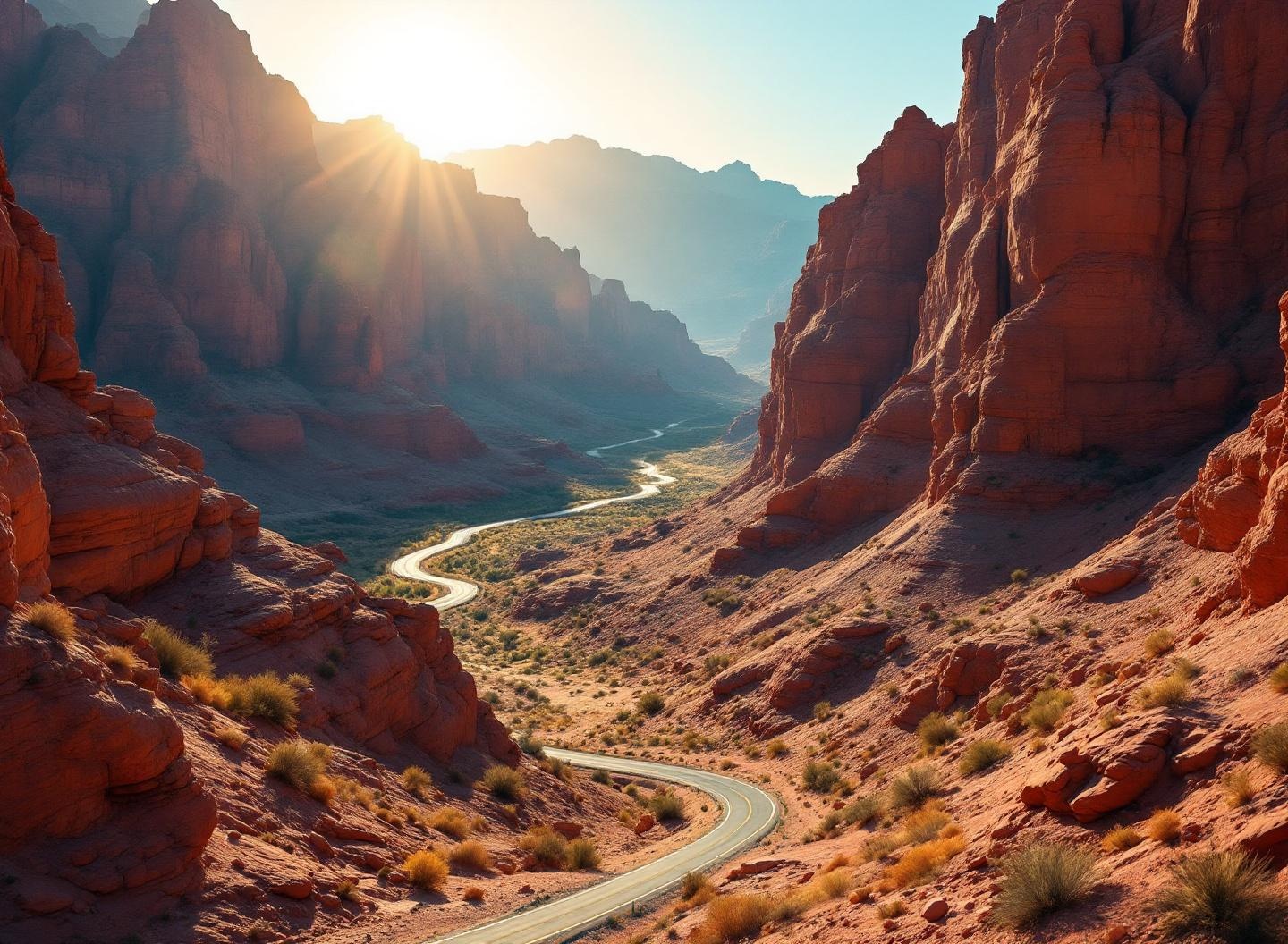
Section 5: Karak to Dana (approximately 120km, 7-8 days) — the iconic middle
This is the section most long-distance hikers cite as the emotional core of the Jordan Trail. It includes the approach to Dana Biosphere Reserve and is often combined with Section 6 into a single Dana-to-Petra narrative.
Terrain: King’s Highway plateau country transitioning to the extraordinary canyon and escarpment system of the Dana Biosphere Reserve.
2025 conditions: The route through Wadi Ghuwair (the canyon approach to Dana from the north) sustained significant erosion damage in winter 2024-25. The Jordan Trail Association completed repairs by April 2025, but the path through the canyon floor is rougher than in previous years. Trekking poles are strongly recommended.
Dana village itself is in excellent shape. The RSCN has invested in the guesthouses and guiding infrastructure, and the quality has improved noticeably.
Water in Dana Reserve: The 2024 dry summer affected some of the springs in the reserve interior. Springs that were historically reliable in October have had reduced flow. The Jordan Trail Association’s current guidance is to carry 4 liters between known water sources in this section rather than relying on spring replenishment. This guidance may change as conditions normalize — check before departure.
Accommodation in Dana: Rummana Campground (RSCN, open March-October only), Dana Guesthouse (RSCN, open year-round), and several community guesthouses in Dana village. The Dana Guesthouse has a spectacular viewpoint terrace.
New in 2025: A family-run guesthouse opened in the village of Qadisiyah, providing an overnight option for the approach to Dana from the north that previously required camping.
Difficulty: Challenging in the canyon sections. The overall length and the altitude variation (from 1500m plateau to 200m in Wadi Araba) makes this a serious undertaking.
Section 6: Dana to Petra (approximately 75km, 4-5 days) — the gold standard
This is the segment that most organized Jordan Trail tours focus on, and for good reason. It takes you from Dana Reserve’s extraordinary canyon country through the Wadi Feynan eco-lodge area, across the Wadi Araba desert lowlands, and into the back entrance of Petra via the ancient Nabataean route.
Terrain: Genuinely varied — canyon walking, desert lowlands (the hottest section), and then the ancient carved landscape of the Nabataean world.
2025 conditions: Good overall. The Feynan area is well-maintained by the Feynan Ecolodge team. The Wadi Araba crossing remains the most demanding section — it is flat but exposed, and in summer is genuinely dangerous due to heat.
The Feynan Ecolodge: This is one of Jordan’s finest accommodation experiences and one of the best eco-lodges in the entire Middle East. Solar-powered, candlelit at night, with extraordinary desert views and food sourced from local Bedouin communities. Book well ahead — it fills up months in advance during peak season.
Water on the Wadi Araba: The lowland desert crossing (approximately 20km) has limited natural water. Carry 4-5 liters for this section. The heat in summer makes this genuinely dangerous — this crossing should not be attempted July-August without specific preparation.
The Petra back door arrival: Entering Petra via the back route — through Wadi Muthlim or the Bab as-Siq area — means arriving at the back of the Monastery rather than at the front of the Treasury. The first glimpse of the carved stone is a genuinely transcendent moment for hikers who have walked for days through wild landscape to get there.
Amman: Dana to Petra 4-day trekking adventureSection 7: Petra to Wadi Rum (approximately 60km, 4 days)
Terrain: The wild landscape south of Petra, transitioning through ancient Nabataean sites into the approach to Wadi Rum.
2025 conditions: This section has the most inconsistent waymarking of the trail. Several hikers reported getting lost near the Beidha (Little Petra) area in late 2024. Download the current GPX track and keep it visible on your device. A local guide for at least the first day of this section is strongly recommended.
Water: Springs are few and their reliability has decreased since the 2024 dry summer. Treat this as a water-carry section.
Accommodation: Very limited outside the endpoints. Wild camping is the primary overnight option for 2-3 nights of this section.
Difficulty: Challenging, primarily due to navigation and water logistics.
Section 8: Wadi Rum to Aqaba (approximately 40km, 2-3 days)
Terrain: Desert and semi-desert, moving from the protected area of Wadi Rum toward the Red Sea coast.
2025 conditions: The Wadi Rum protected area section is well-managed and the path is clear within the park boundary. The stretch south of the park toward Aqaba is more challenging — industrial and military areas require route awareness.
Water: Essentially none on the natural route. Carry full water supply.
Accommodation: Wadi Rum camps at the start. The final night can be in a camp south of the park or pushing to Aqaba.
The arrival: Reaching the Red Sea after 650km from Umm Qais is one of the great moments of long-distance hiking. Several thru-hikers describe it as one of the most emotional experiences of their lives.
Difficulty: The final section is physically easier than the middle sections but demands water discipline.
Jordan Trail: Dana to Petra 4-day trekking tourPlanning the Jordan Trail in 2025: key considerations
Thru-hiking vs. section hiking
The full trail takes approximately 36-40 days for a fit hiker. This is a significant undertaking that requires extensive preparation, a support system, and willingness to manage unpredictable conditions.
Most visitors tackle one or two sections — most commonly Dana-to-Petra (Sections 5-6), which represents the trail’s most spectacular and logistically accessible portion.
Best season
March-May is optimal for most sections. October-November is excellent. Summer is possible in the north but dangerous in the south (Sections 5-8). Winter (December-February) brings flood risk in canyon sections.
Jordan Trail Association
The JTA provides trail maps, GPX files, hiker support, and up-to-date conditions information at jordantrail.org. Their annual trail conditions report is essential reading before departure. They can also assist with accommodation bookings along the route.
Water: the critical 2025 update
Following the 2024 dry summer, several traditionally reliable springs have reduced flow. The JTA’s current recommendation is to treat all natural sources as potentially unreliable and carry water capacity for at least 25km between village water points. Confirm current spring status with the JTA or local guides before setting out on any multi-day section.
FAQ
How long is the Jordan Trail?
Approximately 650km from Umm Qais in the north to Aqaba on the Red Sea.
Which Jordan Trail section is best for beginners?
Section 1 (Umm Qais to Ajloun) has the most moderate terrain. Section 3 (Fuheis to Madaba) is the least demanding. The iconic Dana-to-Petra section is beautiful but challenging.
When does the Jordan Trail open?
The trail is technically open year-round, but certain sections (canyon areas in rain season, hot desert sections in summer) are dangerous outside of March-May and October-November.
Do I need a guide for the Jordan Trail?
For the full thru-hike or for canyon sections, a local guide is strongly recommended. For well-marked sections like Section 1 and the Dana area, a good GPS track and the JTA maps are sufficient for experienced walkers.